The Government of Spain has launched the InfoDANA Recovery Web Viewer, a tool that can be used from today and that will allow citizens to know in detail the progress in the reconstruction of the areas affected by DANA on October 29, 2024 and subsequent days.
This interactive transparency instrument, promoted by the Ministry of Territorial Policy and Democratic Memory and coordinated between the Commissioner for Reconstruction and Reparation of the Damages Caused by DANA and the company Tragsa, offers the possibility of exploring on the map, municipality to municipality, the funds of the Government of Spain that have already been transferred to companies, private self-employed persons and other administrations; and the items already executed or in execution managed directly by the Government of Spain for the recovery of the areas affected by DANA.
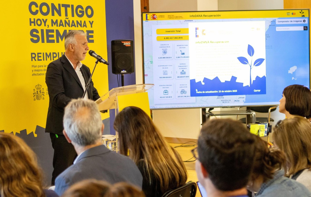
Currently, all the projects in progress and listed in the viewer amount to a total of 6,992 million euros. This tool allows, in an easy and intuitive way, to see where all these resources have been invested thanks to an interactive map that provides geolocalized and detailed data on the investments of the State for reconstruction.
It is a useful transparency tool that had already been presented before to the mayors of affected municipalities, and where from today all citizens can follow the action of the Government on the ground.
The information can be consulted in a general or disaggregated way (by municipality) through a simple menu and the data will be updated periodically, with the incorporation of audiovisual material on the projects carried out.
Each action is geolocated and contains information on investments, in areas such as infrastructure, care for people affected, water cycle or support for companies and self-employed workers, or aid to the primary sector.
In addition, satellite images from before and after the DANA have been added that allow us to check the impact that this extreme phenomenon had on the landscape and infrastructures. The viewfinder will incorporate a third orthophoto when the reconstruction is complete in order to reflect the entire process of change achieved with the reconstruction.
The viewfinder also allows access to supramunicipal actions, such as works in key infrastructures, proximity lines or natural environments of special relevance, including the AP-7 or the natural park of l’Albufera de València.
InfoDANA Recovery is available at the following link: https://infodanarecuperacion.es/visor/